Ban Gioc Waterfall
A large waterfall spanning the border between Vietnam and China, characterized by tiered cascades and a wide pool. Visit early to avoid midday crowds and capture the water in softer light.
Ban Gioc Waterfall wide angle

The Cao Bang Loop spans roughly 450 kilometers of provincial roads through karst peaks, minority villages, and river valleys in Northeast Vietnam. No official map exists—riders navigate using numbered highways, village names, and GPS coordinates shared between travelers. This guide provides the waypoints, terrain notes, and junction details you need to trace the circuit on your own device.
Quick answer
A cao bang loop map plots the circuit through Cao Bang Province along highways QL4A, QL3, and DT207, connecting waypoints including Ban Gioc Waterfall, Nguom Ngao Cave, Pac Bo, and Thang Hen Lake. The loop is a public road network with no entrance fee, typically ridden over three to five days. Most riders start in Cao Bang City, though some begin from Ha Giang or Lang Son. GPS coordinates and village names serve as navigation anchors since road signage is sparse.
The Cao Bang Loop lacks an official designation—it is a rider-coined name for a collection of provincial highways that form a natural circuit through the northeast highlands. Unlike the more famous Ha Giang Loop to the west, no printed map is sold at guesthouses, and Google Maps often fails to render minor roads or estimate accurate travel times on steep grades. Instead, navigation depends on a cao bang loop map you build yourself: downloaded offline tiles, hand-marked waypoints, and odometer readings noted at fuel stops. The circuit follows three primary arteries. Highway QL4A runs north from Cao Bang City toward the Chinese border, passing Ban Gioc Waterfall and the riverside villages of Dam Thuy and Trung Khanh. Highway QL3 sweeps west through Bao Lac and Meo Vac before descending into the Tu San Canyon. Provincial road DT207 completes the triangle, threading through Quang Uyen and re-entering Cao Bang City from the south. Each leg varies in pavement quality—QL4A is fully paved, while DT207 carries sections of gravel and washboard through logging zones. Riders mark their route maps with more than sights. Fuel stations appear every forty to sixty kilometers, but the interval stretches longer on DT207 and near Pac Bo. Mobile signal drops for hours at a time in canyon segments, making downloaded maps essential. Elevation changes are constant: the road climbs above 1,200 meters twice, once near Ma Phuc Pass on QL4A and again approaching the Meo Vac junction. These passes bring fog in early morning and afternoon rain from June through September, which turns visibility near zero and pavement slick. Village names on road signs are written in Vietnamese without diacritics, and many hamlets share similar names—three settlements along the loop are called "Thanh Cong." Cross-reference coordinates rather than relying on placename searches. Most navigation apps place Ban Gioc Waterfall accurately, but lesser-known stops like Thang Hen Lake or Pac Bo Cave require manual pins. Offline mapping platforms such as Maps.me and OsmAnd render the road network more reliably than Google in this region, since their databases pull from OpenStreetMap contributors who have traced the routes on motorbike. The loop is accessible year-round, though landslides occasionally close sections of DT207 during the wettest months. Road crews clear debris within days, but no advance closure notices are posted online. Guesthouses in Cao Bang City and Trung Khanh keep current conditions, and other riders often share detour routes in traveler forums. The best arrival window for starting your ride is between 08:00 and 16:00, when daylight permits safe navigation of unmarked junctions and mountain switchbacks.
“No official map is sold at guesthouses, and Google Maps often fails to render minor roads or estimate accurate travel times on steep grades.”
This four-day circuit suits riders comfortable with mountain roads and basic lodging in remote towns. The route covers roughly 300 km of winding passes, waterfalls, and valley descents.
Depart Cao Bang town heading north on QL4A toward Trung Khanh (60 km). Stop at Pac Bo Cave if time allows, then settle into guesthouse accommodation for the night.
Cross into Ha Giang Province over the forested Phja Oac Pass, one of the loop's quietest stretches. Arrive in Meo Vac by late afternoon; lodge near the Sunday market square.
Ride the Ma Pi Leng panorama—sheer cliffs above the Nho Que River—then descend through Dong Van plateau. Continue south to Ba Be National Park (long day, 120+ km); book lakeside homestay in Pac Ngoi village.
Explore Ba Be Lake by boat in the morning (Puong Cave, Dau Dang waterfall), then return to Cao Bang town via QL3 (65 km). Arrive by mid-afternoon to return rental bikes and catch onward transport.
The Cao Bang Loop is located in Cao Bang Province, Northeast Vietnam. Most travelers reach the region by taking a bus or private car from Hanoi to Cao Bang City to begin their journey.
Hanoi My Dinh Bus Station to Cao Bang City Bus Station
National Route QL3 from Hanoi to Cao Bang City
Private transfer from Hanoi to Cao Bang City
Plan your arrival within the best arrival window of 08:00–16:00 to ensure sufficient daylight for navigating mountain passes.
The Cao Bang Loop features a variety of natural formations and historical landmarks along its winding mountain roads. These locations represent the geography and culture of the Northeast Vietnam region.
A large waterfall spanning the border between Vietnam and China, characterized by tiered cascades and a wide pool. Visit early to avoid midday crowds and capture the water in softer light.
Ban Gioc Waterfall wide angle
A massive limestone cave system extending several kilometers featuring stalactites and underground streams. Walk the designated path to see the primary chambers and rock formations.
Nguom Ngao Cave interior lighting
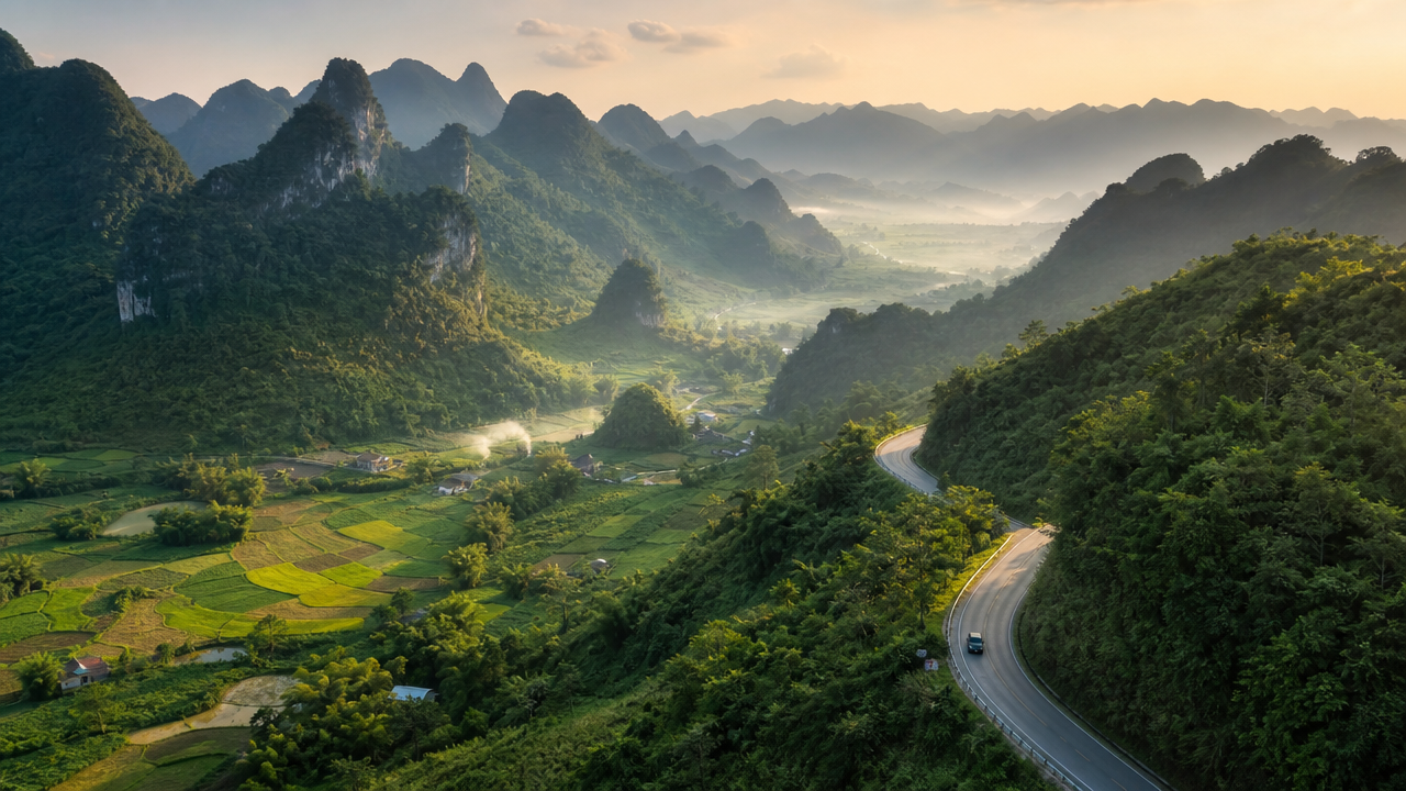
A seven-level mountain pass known for its hairpin turns and panoramic views of the surrounding karst valleys. Pull over at the designated viewpoints to photograph the road curves.
Ma Phuc Pass road view
A historical site where Ho Chi Minh lived and worked upon returning to Vietnam. Explore the grounds to observe the mountain landscape and the Lenin Stream.
Pac Bo Cave historic site
A mountain lake system that changes water levels based on the season, surrounded by steep cliffs and trees. Walk the perimeter trail to view the water reflection.
Thang Hen Lake landscape view
The Cao Bang Loop is a multi-day motorcycle route through mountain passes—prepare your bike, documents, and safety gear before departure.
Everything you need to know about cao bang loop map
While digital navigation tools are helpful, carrying a physical cao bang loop map provides a reliable backup in remote areas with limited cellular coverage. These routes traverse complex karst landscapes and limestone peaks where GPS signal can be inconsistent.
The Cao Bang Loop is a public road network, so there is no entrance fee. You are free to explore the scenic passes and village paths without purchasing tickets.
For optimal daylight for navigating mountain passes and scenic photography, plan your travel within the 08:00–16:00 window. This timeframe ensures you reach your accommodation before dark while enjoying the best visibility of the regional landmarks.
The roads are open 24 hours a day, seven days a week, as the path consists of public infrastructure. However, navigating these remote highland routes at night is discouraged due to safety concerns and lack of lighting.
Traveling this circuit with children requires careful planning due to the winding terrain and long hours on the road. Ensure you are familiar with the cao bang loop map before departing and prioritize frequent stops in local settlements.
Many travelers rely solely on digital navigation and overlook the importance of checking weather conditions and road status. Always cross-reference your cao bang loop map with local updates to ensure your chosen path remains accessible.
Cao Bang Loop Price
Read more GuideCao Bang Loop Route
Read more Tickets & toursCao Bang Loop Tour Companies
Read more GuideCao Bang Loop Packing List
Read more Tickets & toursCao Bang Loop Easy Rider
Read more GuideCao Bang Loop vs Ha Giang
Read more Tickets & toursCao Bang Loop from Hanoi
Read more GuideCao Bang Loop Police Checkpoints
Read more