
English| EUR
Suggested for you
More currencies
Choose a language
Northeast Vietnam offers two legendary motorbike circuits, each winding through karst peaks and minority villages, yet the experience on each differs sharply. This guide breaks down terrain difficulty, tourist density, permit logistics, and the landscapes that define each loop so you can match the route to your skills and expectations.
Quick answer
The Cao Bang loop covers approximately 300 kilometers through Northeast Vietnam's quieter borderlands, passing Ban Gioc Waterfall and requiring no special travel permit, while the Ha Giang loop spans roughly 350 kilometers with more technical mountain passes, denser tourist traffic, and mandatory permit registration in Ha Giang city. Cao Bang suits riders seeking solitude and waterfall landscapes; Ha Giang delivers dramatic high-altitude karst and iconic viewpoints but with significantly more motorbikes on the road during peak months.
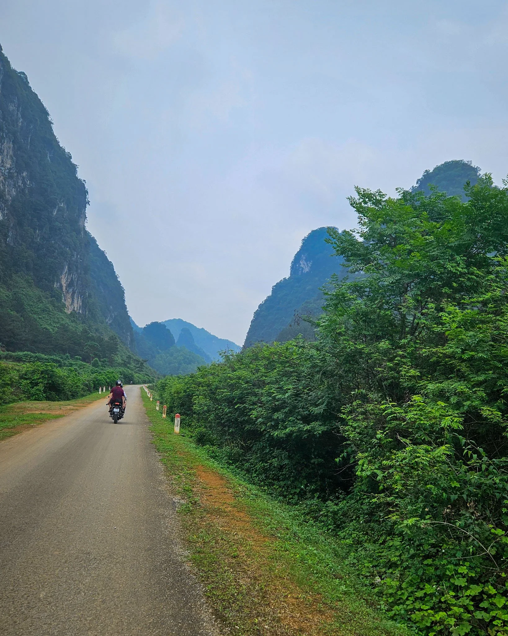
The Ha Giang loop became Vietnam's most famous motorbike route by 2018, its reputation built on the vertiginous turns of Ma Pi Leng Pass and the layered limestone formations visible from Dong Van plateau. What began as a backpacker secret now sees hundreds of riders daily during dry season, with guesthouses in Dong Van and Meo Vac booked weeks ahead. The cao bang loop vs ha giang question matters because the infrastructure, crowd density, and riding environment diverged sharply after 2020. Cao Bang Province shares the same geological theater—towering karst, terraced valleys, Tay and Nung villages—but the loop remains a secondary circuit. Most riders arrive via the eastern route from Lang Son or the northern spur from Ha Giang itself, following QL34 and QL4A through Trung Khanh district to Ban Gioc Waterfall, then looping back through Nguom Ngao Cave and Pac Bo. The roads are smoother overall; fewer switchbacks demand advanced throttle control. That accessibility comes with trade-offs: the highest passes top out around 1,200 meters, lacking the thin-air drama of Ha Giang's 1,800-meter ridgelines. Permit requirements separate the two decisively. Ha Giang's northern districts fall within a restricted border zone; all foreign visitors must register in Ha Giang city and carry the stamped document throughout the loop. Cao Bang's route lies outside that boundary. Riders enter freely, stop where they choose, and alter the itinerary without notifying authorities. The administrative simplicity appeals to solo travelers and anyone wary of fixed schedules. Scenic character splits along waterfall versus altitude lines. Cao Bang delivers Ban Gioc's twin cascades and the surrounded-by-green aesthetic of river valleys; Ha Giang offers exposed ridgeline riding where the road clings to cliffsides with no guardrail and no trees, only air and distant peaks. Photographers favor Ha Giang's scale; riders who prioritize smooth tarmac and fewer selfie-stick stops lean toward the northern loop alternative. The cao bang loop vs ha giang choice ultimately reflects whether you value isolation and waterfalls or are willing to share the road for Ha Giang's iconic high-altitude panoramas. Crowd dynamics shifted after 2022. Ha Giang's popularity plateaued but remains concentrated; Cao Bang's visitor numbers grew modestly, enough to improve guesthouse quality in Trung Khanh and Quang Uyen without saturating the route. Riders seeking the Central Highlands' old quiet—before Dalat's loops filled—find it now along Cao Bang's QL34 stretches, where an hour can pass between encountering another foreign motorbike.
“Cao Bang delivers the karst drama without the convoy of rental bikes that now defines Ha Giang's peak-season experience.”
Ha Giang is typically covered in 3–4 days with a standard loop format, while Cao Bang demands at least 4–5 days due to its dispersed landmarks and rougher terrain. The extra time accounts for longer transfer distances between Ban Gioc, Nguom Ngao Cave, and Pac Bo, plus slower riding conditions on less-developed roads.
Depart early and ride northeast toward Ban Gioc Waterfall, stopping at viewpoints along QL34. Allow 3–4 hours for the 90 km journey, factoring in winding passes and photo breaks.
Visit the waterfall at first light to avoid crowds, then explore Nguom Ngao Cave 3 km away—budget 90 minutes inside. Return to Trung Khanh or push on to Dam Thuy Lake if daylight permits.
Loop through remote Nung and Tay villages, then descend to Pac Bo Cave near the Chinese border. The route covers 120 km with minimal services, so carry water and snacks.
Ride southwest through Tra Linh, pausing at Thang Hen's cluster of 36 lakes if water levels are high. Arrive back in Cao Bang City by late afternoon, completing the circuit.
If combining both loops, allocate 7–8 days total: Ha Giang's tighter geography allows faster daily distances, while Cao Bang's spread-out sights require slower pacing and earlier starts.
Cao Bang and Ha Giang are both situated in the mountains of Northeast Vietnam and are primarily accessed via bus or private car from Hanoi. Most travelers depart from Hanoi to either Cao Bang City or Ha Giang City to begin their respective loops.
Hanoi My Dinh Station to Cao Bang City via QL3
Hanoi My Dinh Station to Ha Giang City via QL2
Private transfer from Hanoi via QL3 or QL2
The best arrival window is 08:00–16:00 to ensure optimal daylight for navigating mountain passes and scenic viewing. As this is a public road route, the address is Cao Bang Province, Northeast Vietnam.
The period from September to October and April to May offers the most stable conditions for both loops, balancing clear skies with comfortable temperatures. Planning your rides within the best arrival window of 08:00–16:00 ensures optimal daylight for navigating mountain passes safely.
Dry, 20°C–28°C
Harvest season turns rice terraces gold, providing clear mountain visibility.
Mild, 18°C–26°C
Spring weather remains dry with comfortable temperatures for long rides.
Hot, 25°C–32°C
Expect higher humidity and potential for heavy, sudden rainfall.
—
Local traffic is minimal, providing quiet conditions on mountain roads.
Verdict: The optimal time to ride is during the dry months of September or October, departing daily between 08:00 and 16:00.
The Cao Bang Loop and Ha Giang Loop are public road networks, meaning there are no entry fees required to access these routes. Costs for visitors are determined by personal travel choices rather than official admission charges.
Verdict: An adult pays 0 VND for route access, with total trip costs varying based on vehicle rental, fuel, and accommodation.
Everything you need to know about cao bang loop vs ha giang
Choosing between cao bang loop vs ha giang depends on your preference for limestone karsts versus expansive waterfalls and caves. Ha Giang is renowned for its dramatic mountain passes, while Cao Bang offers a more serene landscape with significant natural landmarks like Ban Gioc Waterfall. Both routes provide distinct cultural experiences in Northeast Vietnam.
Yes, the terrain is a primary factor when evaluating cao bang loop vs ha giang. Ha Giang features steeper, more challenging switchbacks suitable for experienced riders, whereas Cao Bang presents a mix of mountain riding and valley plains. Your choice should reflect your comfort level with winding motorbike roads.
The routes differ primarily in their primary attractions and road accessibility. While Ha Giang is famous for the Ma Pi Leng Pass, Cao Bang centers around the UNESCO Global Geopark features and border scenery. Travelers often weigh the intensity of the ride against the specific sites they wish to see.
There is no entrance fee for the cao bang loop itself as it consists of public roads. You may encounter ticketed entry points for specific attractions like waterfalls or caves, but the loop transit is free. Always carry your documentation when traveling through border regions.
The best arrival window for navigating mountain passes is 08:00–16:00 to ensure optimal daylight. This timeframe allows for safer riding conditions and better visibility of the surrounding landscapes. Avoid late evening transit due to limited visibility on these remote roads.
Cao Bang generally offers a more tranquil atmosphere compared to the increasingly popular Ha Giang circuit. If you prefer fewer crowds and a slower pace, exploring the border province of Cao Bang may align better with your travel goals. Both areas remain authentic destinations for adventurous riders.
Ha Giang is currently more frequented by international tourists due to its established infrastructure for motorbike rentals and homestays. Cao Bang maintains a quieter profile, appealing to those seeking an off-the-beaten-path journey through northern provinces.
Cao Bang Loop Map
Read more GuideCao Bang Loop Price
Read more GuideCao Bang Loop Route
Read more Tickets & toursCao Bang Loop Tour Companies
Read more GuideCao Bang Loop Packing List
Read more Tickets & toursCao Bang Loop Easy Rider
Read more Tickets & toursCao Bang Loop from Hanoi
Read more GuideCao Bang Loop Police Checkpoints
Read more